Coordinate Geometry Class 9 Maths Chapter 1 – Short Notes, Mind Maps & Key Formulas
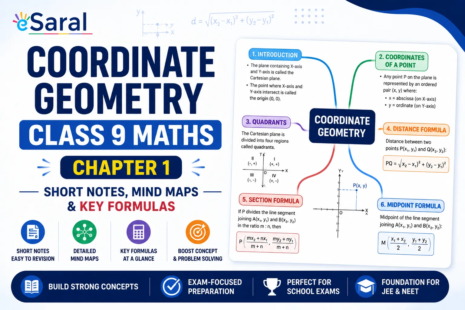
Table of Contents

Home » Class 9 Maths » Coordinate Geometry Class 9 Maths Chapter 1 Notes

What Is Chapter 1 About in Class 9 Maths (New Syllabus)?
Chapter 1 of the new Class 9 Maths textbook Ganita Manjari (Part I) is titled Orienting Yourself: The Use of Coordinates. This chapter introduces students to the two-dimensional Cartesian coordinate system, one of the most fundamental concepts in mathematics.
Under the NEP 2020 and NCF-SE curriculum, the chapter focuses on real-life applications of coordinate geometry while also highlighting its historical development. Students learn how coordinates are used to identify the exact location of objects on a plane, how the coordinate axes divide the plane into four quadrants, and how distances between points can be calculated using the Baudhāyana–Pythagoras theorem.
This chapter forms the foundation for several important topics taught in higher classes, including linear equations in two variables, graphing functions, coordinate geometry, and analytical geometry in Classes 10, 11, and 12. It also establishes concepts that are frequently used in competitive examinations, such as JEE Main.
Students looking for detailed exercise-wise explanations can refer to the complete Ganita Manjari Solutions available on eSaral.( Coming Soon)
The 2-D Cartesian Coordinate System
Key Terms and Definitions
| Term | Definition |
|---|---|
| Coordinate System | A structured framework that uses two perpendicular lines to describe the position of any point on a plane. |
| x-axis | The horizontal axis of the coordinate plane. |
| y-axis | The vertical axis of the coordinate plane. |
| Origin (O) | The point where the x-axis and y-axis intersect. Its coordinates are $(0,0)$. |
| Cartesian Plane | The plane formed by the x-axis and y-axis is also called the coordinate plane or xy-plane. |
| Coordinates $(x,y)$ | An ordered pair representing the horizontal distance from the y-axis and the vertical distance from the x-axis. |
Important Points to Remember
- The x-coordinate (abscissa) represents the horizontal distance from the y-axis.
- The y-coordinate (ordinate) represents the vertical distance from the x-axis.
- Distances measured to the right of the origin and upward from the origin are positive.
- Distances measured to the left of the origin and downward from the origin are negative.
- Any point on the x-axis has coordinates of the form $(x,0)$.
- Any point on the y-axis has coordinates of the form $(0,y)$.
- The origin always has coordinates $(0,0)$.
- The order of coordinates is important. If $x \neq y$, then $(x,y) \neq (y,x)$.
Quadrants of the Cartesian Plane
The x-axis and y-axis divide the Cartesian plane into four regions called quadrants. These quadrants are numbered in an anticlockwise direction, beginning from the upper-right region.
Sign Convention in the Four Quadrants
| Quadrant | x-coordinate | y-coordinate | Example |
|---|---|---|---|
| Quadrant I | Positive (+) | Positive (+) | $(3,4)$ |
| Quadrant II | Negative (−) | Positive (+) | $(-5,3)$ |
| Quadrant III | Negative (−) | Negative (−) | $(-3,-4)$ |
| Quadrant IV | Positive (+) | Negative (−) | $(3,-5)$ |
Special Cases
- Points lying on the x-axis, such as $(4.5,0)$, do not belong to any quadrant.
- Points lying on the y-axis, such as $(0,4)$, do not belong to any quadrant.
- The origin $(0,0)$ does not belong to any quadrant.
Always remember that the x-coordinate is written first and represents horizontal movement, while the y-coordinate is written second and represents vertical movement. Maintaining the correct order of coordinates is essential while plotting or reading points on the Cartesian plane.
How Do You Plot a Point on the Cartesian Plane?
Plotting points on the Cartesian plane is one of the most fundamental skills in coordinate geometry. Once students understand how to locate points accurately, they can easily solve graph-based questions, coordinate geometry problems, and higher-level mathematics topics in later classes.
Steps to Plot a Point $P(x,y)$
- Draw the horizontal x-axis and the vertical y-axis so that they intersect at the origin O.
- Mark equal units on both axes.
- Starting from the origin, move $|x|$ units to the right if $x>0$ or $|x|$ units to the left if $x<0$.
- From that position, move $|y|$ units upward if $y>0$ or downward if $y<0$.
- Mark the final position and label the point.
How to Read Coordinates from a Graph
To determine the coordinates of a point already plotted on a graph:
- Draw a perpendicular from the point to the x-axis to identify the x-coordinate.
- Draw a perpendicular from the point to the y-axis to identify the y-coordinate.
- Write the coordinates in the correct order as $(x,y)$.
Always remember that the horizontal value is written first, followed by the vertical value.
Distance Formula
The distance formula helps determine the shortest distance between two points on the Cartesian plane. It is derived from the Baudhāyana–Pythagoras theorem by constructing a right triangle using the horizontal and vertical distances between two points.
Distance Between Two General Points
If the coordinates of two points are $P(x_1,y_1)$ and $Q(x_2,y_2)$, then the distance between them is given by:
$$PQ=\sqrt{(x_2-x_1)^2+(y_2-y_1)^2}$$
This formula is applicable regardless of whether the coordinates are positive, negative, or zero.
Special Cases of the Distance Formula
| Situation | Distance Formula |
|---|---|
| Both points lie on the x-axis: $(x_1,0)$ and $(x_2,0)$ | $|x_2-x_1|$ |
| Both points lie on the y-axis: $(0,y_1)$ and $(0,y_2)$ | $|y_2-y_1|$ |
| One point is the origin: $O(0,0)$ and $P(x,y)$ | $\sqrt{x^2+y^2}$ |
| General case: $P(x_1,y_1)$ and $Q(x_2,y_2)$ | $\sqrt{(x_2-x_1)^2+(y_2-y_1)^2}$ |
Important Note About Signs
The signs of $(x_2-x_1)$ and $(y_2-y_1)$ do not affect the final answer because both quantities are squared before they are added. As a result, the distance between two points is always non-negative.
Solved Example
Find the distance between the points $A(3,4)$ and $D(7,1)$.
- Horizontal distance = $7-3=4$
- Vertical distance = $4-1=3$
- Distance $=\sqrt{4^2+3^2}$
- $=\sqrt{16+9}$
- $=\sqrt{25}=5$ units
Mastering the distance formula at the Class 9 level builds a strong foundation for advanced topics such as circles, triangles, coordinate geometry, loci, and analytical geometry that are studied in higher classes and competitive examinations.
Midpoint and Trisection of a Line Segment
Besides calculating distances, coordinate geometry also helps determine points that divide a line segment into equal parts. The midpoint and trisection formulas are frequently used in school examinations and provide the foundation for advanced coordinate geometry studied in higher classes.
Midpoint Formula
If the endpoints of a line segment are $S(x_1,y_1)$ and $T(x_2,y_2)$, then the midpoint $M$ is given by:
$$M=\left(\frac{x_1+x_2}{2},\frac{y_1+y_2}{2}\right)$$
The midpoint is obtained by taking the average of the corresponding x-coordinates and y-coordinates of the two endpoints.
Trisection Points
If two points divide a line segment $AB$ into three equal parts, where $P$ is closer to $A$ and $Q$ is closer to $B$, their coordinates are:
$$P=\left(\frac{2x_1+x_2}{3},\frac{2y_1+y_2}{3}\right)$$
$$Q=\left(\frac{x_1+2x_2}{3},\frac{y_1+2y_2}{3}\right)$$
Collinearity of Three Points
Three points are said to be collinear if they lie on the same straight line.
The condition for collinearity can be verified in either of the following ways:
- The sum of the two smaller distances equals the largest distance.
- The area of the triangle formed by the three points is equal to zero.
Historical Background of Coordinate Geometry
The new Ganita Manjari textbook highlights the historical development of coordinate geometry and acknowledges the contributions of Indian mathematicians and ancient civilizations.
Major Historical Contributions
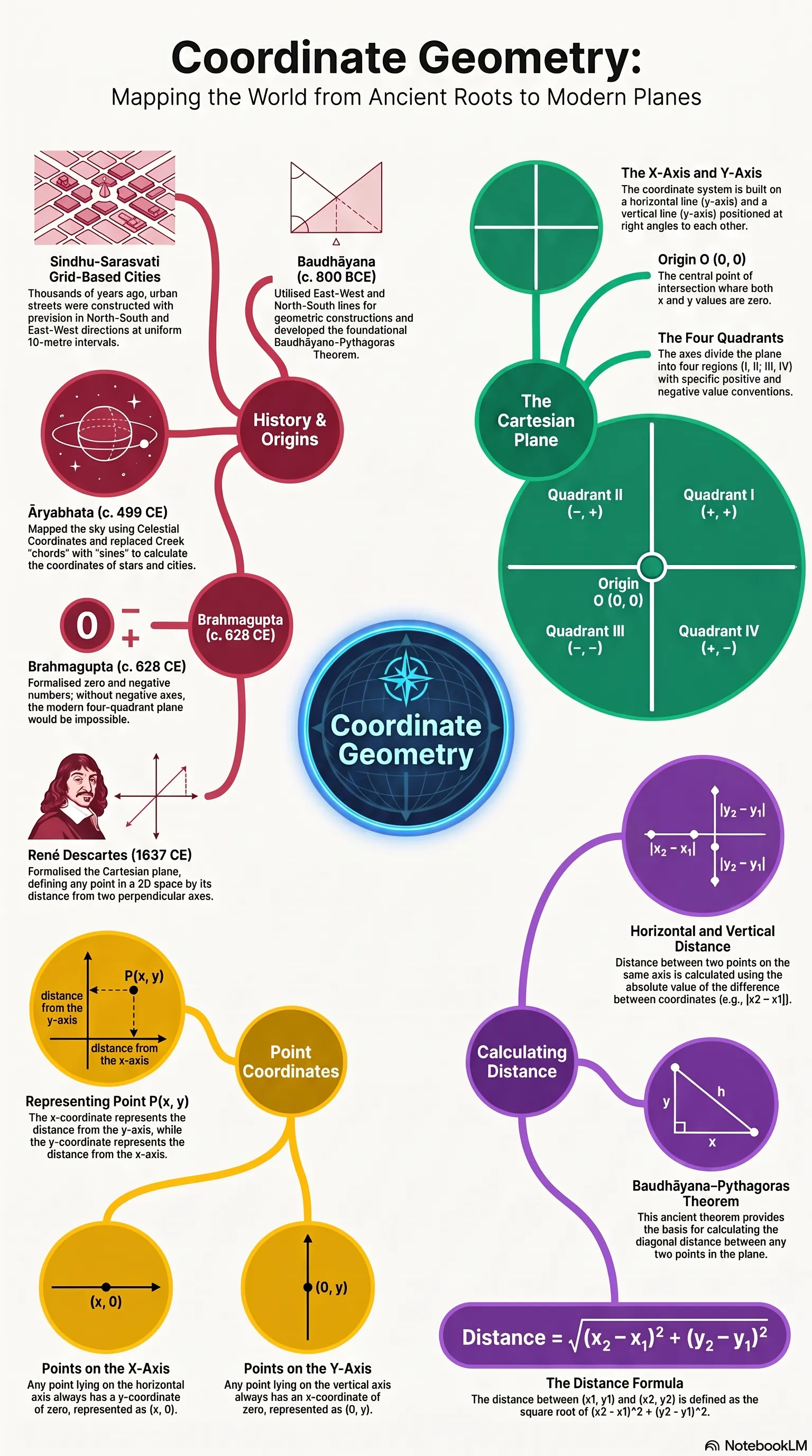
- Sindhu-Sarasvatī Civilisation: Used systematic grid-based city planning with streets arranged in north-south and east-west directions, demonstrating an early practical application of coordinate systems.
- Baudhāyana (c. 800 BCE): Developed geometric principles involving perpendicular lines and introduced what is now known as the Baudhāyana–Pythagoras Theorem.
- Ujjayinī: Served as the prime meridian for ancient Indian and early Arab astronomical and geographical calculations.
- Āryabhaṭa (c. 499 CE): Replaced Greek chord methods with sine functions, making astronomical coordinate calculations simpler and more accurate.
- Brahmagupta (c. 628 CE): Formalised the use of zero and negative numbers, concepts that are fundamental to the modern four-quadrant coordinate system.
- René Descartes (1637 CE): Systematically developed the modern Cartesian coordinate system, combining earlier mathematical ideas into the analytical geometry used today.
Conclusion
Chapter 1, Orienting Yourself: The Use of Coordinates, lays the groundwork for coordinate geometry by introducing the Cartesian plane, plotting of points, distance formula, midpoint, trisection, and collinearity. Mastering these concepts at the Class 9 level prepares students for more advanced topics in Classes 10, 11, and 12, while also building a strong foundation for competitive examinations.
Students can further strengthen their understanding by practising all textbook exercises through the complete Ganita Manjari Solutions for Class 9 available on eSaral. Those interested in exploring coordinate geometry in greater depth can also refer to the Class 10 and Class 11 coordinate geometry resources for advanced practice and conceptual clarity.
Frequently Asked Questions
Find answers to common questions.
What is the distance formula in Class 9 Coordinate Geometry?
The distance between two points P(x₁, y₁) and Q(x₂, y₂) is given by PQ = √[(x₂ – x₁)² + (y₂ – y₁)²]. This formula is derived from the Baudhāyana–Pythagoras theorem. The sign of the differences does not matter since both terms are squared. For special cases: if both points are on the x-axis, the distance is simply |x₂ – x₁|; if both are on the y-axis, the distance is |y₂ – y₁|.
What are the four quadrants in the Cartesian plane?
The coordinate axes divide the Cartesian plane into four regions called quadrants. Quadrant I has both coordinates positive (+, +). Quadrant II has a negative x-coordinate and positive y-coordinate (–, +). Quadrant III has both coordinates negative (–, –). Quadrant IV has a positive x-coordinate and negative y-coordinate (+, –). Points on the axes themselves do not belong to any quadrant.
What is a coordinate system in Class 9 Maths?
A coordinate system is a structured framework using two perpendicular lines — the x-axis (horizontal) and y-axis (vertical) — to describe the exact location of any point in a two-dimensional plane. Every point is identified by an ordered pair (x, y), where x is the horizontal distance from the y-axis and y is the vertical distance from the x-axis. The point where both axes meet is called the origin, with coordinates (0, 0)
Why is Chapter 1 Coordinate Geometry important for JEE?
Coordinate geometry carries very high weightage in JEE Main, appearing in topics like straight lines, circles, parabolas, ellipses, and hyperbolas. The foundational skills built in Class 9 — plotting points, applying the distance formula, finding midpoints, and understanding quadrant sign conventions — are used extensively in every coordinate geometry question in Classes 11 and 12. A strong Class 9 base significantly reduces the learning effort needed at the JEE preparation stage.
How do you check if three points are collinear?
Three points are collinear — they lie on the same straight line — if the distance between the two outer points equals the sum of the distances from each outer point to the middle point. Another method is to check if the area of the triangle formed by the three points equals zero. Both methods work for any combination of positive and negative coordinates.
What is the midpoint formula in Class 9?
If M is the midpoint of the line segment joining S(x₁, y₁) and T(x₂, y₂), then the coordinates of M are ((x₁ + x₂)/2, (y₁ + y₂)/2). The midpoint's x-coordinate is the average of the x-coordinates of the endpoints, and its y-coordinate is the average of the y-coordinates of the endpoints.